Search

Beer, ale … whatever.

Digital planner, likes good pubs. Breaks that rule about discussing politics over beer.

Category

Pennine Way

Tales from a walk with my Dad

Hawes to Keld

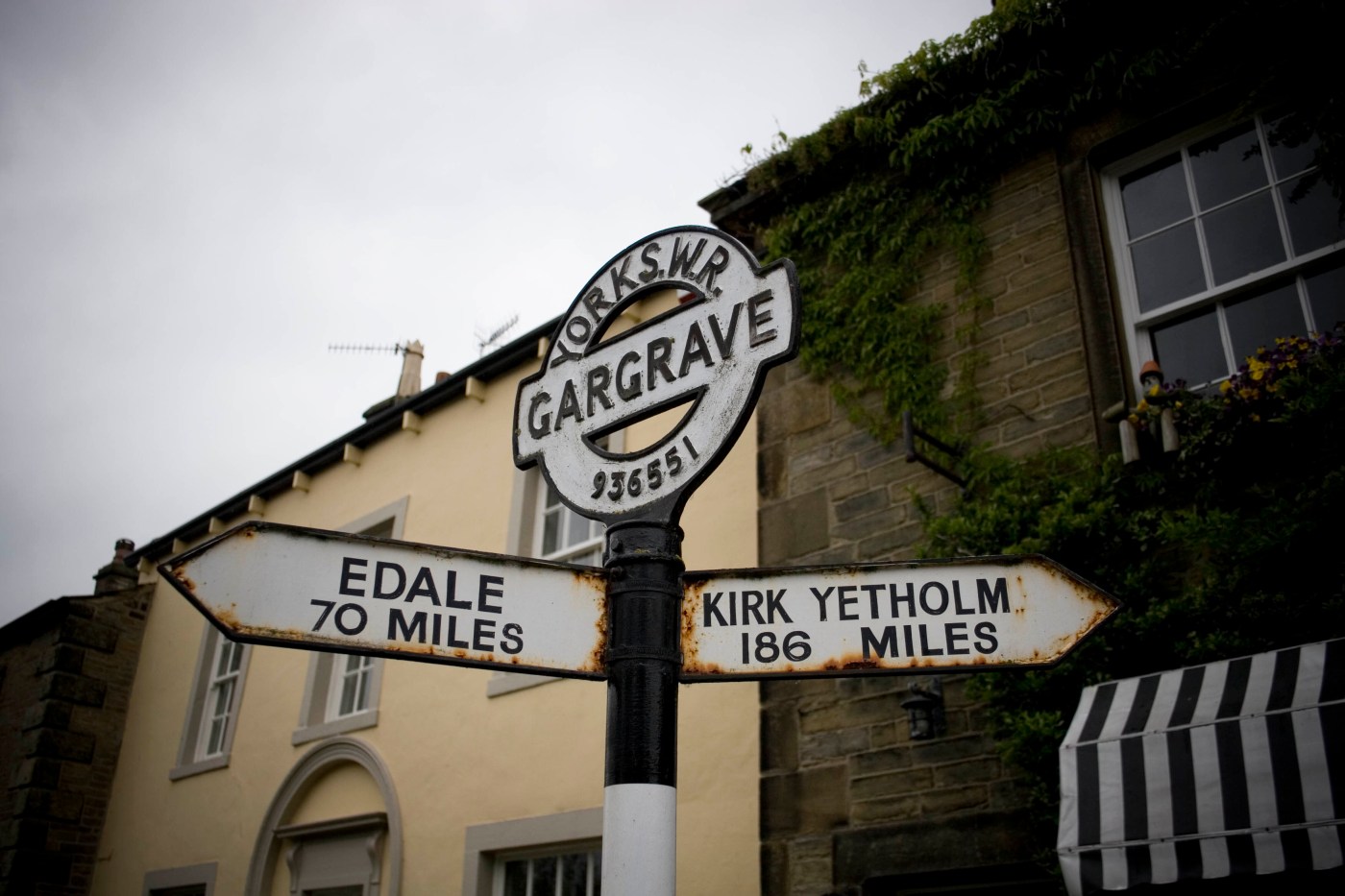
Day one starts with meadows and gentle fields punctuated with the endless curves of streams on ox-bow trajectories, and meandering roads that leave Hawes for the far corners of Wensleydale. Farmland gives way to sheep enclosures; muddy tracks give way to open access boundaries. Before long the gentle slope matures into the lekking grounds of High Abbotside, and the steep and rocky ascent of Great Shunner Fell.

At 1,000 feet the heavy sky suddenly seems closer, but grouse are nowhere to be seen. At fifteen hundred feet the pregnant clouds are voluptuous and imposing, rubbing up against the rising landscape with contempt. And the grouse are still hiding.

At 2,000 feet Wensleydale is a green corner of a skyline dominated by swathes of brown gaming moorland. Once barren moors – restored to full health by private ownership and dedication – weigh down the hill; hills that would be rugged if they weren’t so smoothly carved by glaciers and weather.

Suddenly, atop the fell, the winds change and we’re treated to a chilling breeze for elevenses. The legions of clouds become agitated; they maraud above us, a snail’s pace juggernaut oblivious to the dales beneath.

After a gloomy morning’s climb Great Shunner is defeated; the reward is the northward descent, a landscape of Tolkien proportions. Turner could paint a scene of a thousand blues and browns; Hockney might emphasise the startling definition between the skyline that hugs the endless horizon of moss and grass.

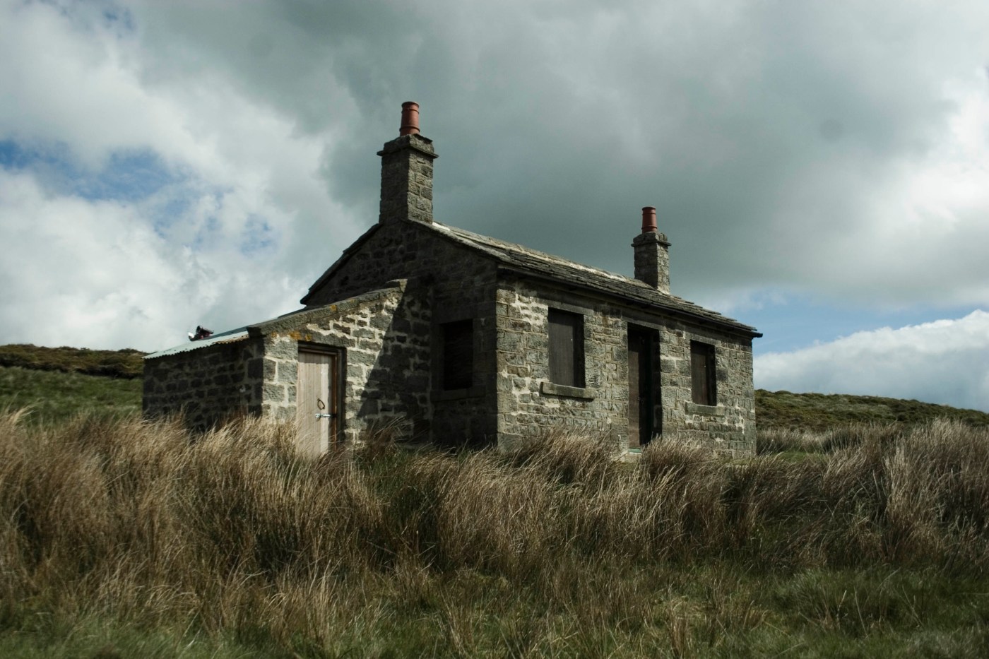
By afternoon we’ve descended from Middle Earth into the Shire via rocky tributary lanes towards the dormant village of Thwaite and past the ancient farm outhouses of Swaledale along paths strewn with rabbit corpses.

Soon we’re above the valley again, following the snaking path of the Swale. From our vantage point the history of the river is laid bare – every stealthy, eroding year, every rock that was too strong for the youthful water. The valley floor is an ancient wandering nomad’s paradise, and pondering the distinct lack of civilisation the sun wins its battle o’er cloud. We have no need to settle near the banks of the Swale, we have tea in a flask and Mars bars saved from lunch. We roll the rain covers away in a burst of afternoon optimism.

Out of the blue we see a pheasant stag poking its head vigorously through the shallow foliage, in a small edge of forest clinging by the scruff of its trunks to the hillside. Iridescent in the sun and unmistakable, he is joined by a shy hen and there rituals are watched by a small flock of seemingly amused sheep.

The sky suddenly creaks and groans. It can’t be thunder, why did we pack the covers away? But then no, its an engine, a plane surely? We look up and there’s nothing but clear blue sky, before, in a flurry of menancing power and bravado, a dark green winged machine bursts through the valley, taunting gravity, wings perpendicular to sea-level. Its whoosh is gone almost as soon as it appeared but for a few seconds Swaledale reverberates and then… silence. The valley seems even quieter than it was before.

The brute force of the plane is in stark contrast to the most graceful of grouse, swooning out of the sky and gliding towards Keld. It’s a secret view, looking down on a bird flying, and a rare easily-spooked bird to boot. Grateful we trudge on in its wake. “Keld must be just around this corner”.

Five or six corners and a few miles later the small and, until recently, dry town pops into view behind green and luscious fields.

At Keld Lodge, responsible for the village’s new found alcohol license, curried banana soup is ordered for starters, with lamb to dine on. 40 winks before tea, then a sneaky pint to whet the appetite (as if 12 and three quarter miles across varied altitudes and unruly terrain wasn’t enough).

The soup does what it says on the tin: banana + curry sauce. Pilsner Urquell and bread substitute for the fish shop chips that might have been the perfect accompaniment, whilst Black Sheep bitter washes down local meat and potatoes. After tea we retire to the drinking room with pints of Riggwelter, a sleeping potion for walkers crafted from the finest fruitcake and chocolate Horlicks.

Nodding off we count our blessings as three groups of Coast to Coast walkers share tales of horrendous conditions in the Lakes a few days ago: ferocious winds, men lifted off the ground, couples on cliff edges and roads closed to flooding.

As we cradle our nightcaps the Pennine Way seems a doddle. And then we remember that the following day is a 22 miler….

Keld to Middleton-in Teesdale

By my calculations we’ll reach Tan Hill Inn at… Oh. 11.15. Shit.”

Best laid plans for lunch and beer at England’s highest inn are scuppered, because it’s a 22 mile day and we’re keen to arrive at Middleton in time to watch Messi & co in the Champions League final. An 11 o’clock pint stop probably isn’t the best way to ensure safe passage over some of England’s most remote and boggy moors.

It’s a freezing Saturday and gloomy too. Keld and Swaledale are covered in mist as we rise above them past swelling waterfalls and dull sheep pastures. It’s 9am and there is no sign of yesterday’s resurgent sun.

Through the rain we can’t see much of the small uninhabited valleys; the electric squawk of the curlews only serves to reiterate our isolation from all but nature and ruined limestone barns.

By 10.23 we’re crossing on the most northerly roads in Yorkshire. This is Tan Hill and its famous inn, the highest public house above sea level in England. We stop all too briefly to change the map in the porch – awkwardly our next 4 miles takes us along the cusp of OS Explorer OL30 and my folding abilities are tested to the max (if there’s a record for ‘getting in the way of a busy public entrance’ then my ineptness at folding an Ordnance Survey into a plastic map protector broke it with ease).

Tan Hill Inn is buzzing with stretching residents and sweating passersby: a motorcycle club, a cycle race and pursuers of various water sport activities are filling up with caffeine or stopping for glucose.

Reluctantly we walk on leaving England’s most remote public house to cross one of England’s remotest moors. Strangely, the next hour is a surreal march against hundreds of spinning wheels and dazzling leotards as weekend cyclists make the most of the mild weather racing conditions.

To our left, due north, Sleightholme Moor stretches out as far as the eye can see, boggy and unkempt. In the distance, cars barely move along the A66 which we pass under later in the afternoon. It’s a wilderness, the only signs of human interference the stone tracks, occasional cairn and sporadic grouse butts. Oh and of course the moors themselves: man-made but forgotten by all but conservationists and game shooters. Leggy heather dominates the landscape. Small patches are burnt to the ground to allow new growth; the result appears as a strange lunar desert in a parallel universe where it was once occupied but left in a hurry.

The moorland gets to your after a while, so much so on a brief foray into arable enclosures we lose the trail whilst thinking about our stomachs. Lunch is devoured on uncomfortable stones and thistles and straight after we soon come to a dead end: a gorging river on one side and a sheer cliff face on the other. Ahead a farm behind barbed wire. The compass suggests that the only option is the cliff. Cue a hands and knees scramble 60 feet to the top. Our packs suddenly feel heavy.

At the top of the cliff dirty hands have to deal with unavoidable barbed fencing that separates us from the comfort blanket of Pennine Way way markers, so over we go and somehow avoid falling backwards to an undignified end.

Some hours later we’ve finally crossed the caravan-laden A66 (much less glamorous than its American namesake). We’re rising to the moors final test, another 600m above sea level from yet another valley bottom. Every mile represents two in this part of the world thanks to the terrain and the weather. The Way becomes non-existent and we keep on the trail only by recognising the thin black lines that represent walls and fields on the map. Bog takes over, boots start to feel damp. The entire sky disappears under deep charcoal clouds.

It rains for the next hour and the bog becomes marsh for much of the long slog over Bowes. Welcome to Durham County. For some reason I’m find myself adapting Bruce Springsteen lyrics for the Pennine Way. The moors will do this sort of thing to you…

We’ve done perhaps 13 miles already and still ahead of us are the first of the Northumberland reservoirs. Then we hit surprise sunshine and a glorious plush valley picture perfect as if waiting to become a Nikki Corker postcard. Hannah’s meadow is here, once home of Hannah Hauxwell, the daughter of the Dales.  We pass nature reserves, farmland and meadows, but still there’s 6 miles to go until Teesdale and more hills to test our legs. Football and beer seem like a promise that the day never intended to keep.

At last though, dizzy with fatigue the final few hundred feet are climbed and Teesdale opens up below, Middleton in the middle and windy meadows everywhere in-between.

Not content to let the terrain have all the fun, huge clouds are edging through the valley on the prevailing wind, with wisps of raindrop-heavy mist below, acting as the infantry to the cavalry above.

We’re for another soaking and can only hope that the hotel has a drying room and decent beer. Talk about tempting fate…

Across A Cross Fell

Morning in Dufton is heavenly. Soft light glistens on the village green, the distant hills are misty, and the birds seemingly haven’t slept, instead devoting every moment, dark or light, to their celestial symphonies.

No wonder it’s called the Vale of Eden. And the prospect of exploring Cumbria’s fertile land spurs us to leave Dufton. That and the unenviable comfort of youth hostel bedding…

Within minutes of joining the Way we’re surrounded on all sides by undulating fields of faultless farmland dressed in a glorious, consistent green. The land is all one hue, the only difference in colour between fields achieved by the sun that dances on the curvatures of the land. Nature creates art with the shadows of millions of blades of grass, a silent spectacle unfolding beneath a cloudless sky.

As we rise above Cosca Hill, fresh faced and glad we didn’t win a week’s worth of beer at the quiz the previous night, the terrain dissolves into the no man’s land between moor and field; trees thin out, streams narrow, and hedgerows give way to the resilience of reeds and gorse. Greenery darkens, the sun rises towards its late morning perch above the verdant cone of Dufton Pike. Against a dull hill the rigid blue sky is speckled with ever watchful radomes bouncing radio waves against passenger planes in the sky.

This eerie place sits 1000 feet above Dufton. It’s a tough climb for the first day, and our route avoids the curiously new road surface that curves up towards the heavenly looking golf balls. Just to spite us, the detour naturally involves the circumnavigation of a disused quarry shaft, appropriately named ‘Dunfell Hush’ which is exactly the sounds of falling down it when miles away from another living creature. Luckily we skip over any hidden mine shafts and the path pop us right up against the radomes. The spooky spheres are less angelic up close, coloured in roughly with worn-off white and sat atop windowless square boxes that looks like they’d blow away in a gentle gust. They look less airport security and more hideout for mad scientists trying to create a real life Day of the Triffids. On the cheap.

We’re not halfway done for the day but lunch is calling. The afternoon trek towards our hostel seems an age away. We can’t even begin to think of a pub yet…

Our lunch stop marks the tallest part of the entire Pennine Way so far, surpassing the more foreboding features of even the Three Peaks of Whernside, Ingleborough and Pen Y Ghent. Cross Fell’s summit roars with wind and we join two southbound walkers sheltering behind the meagre walls of its dry stone cairn. The air is pregnant with cold and hot air which sweeps along the inclines of the fell and gives birth to the Helm Bar, an innocuous enough looking line of cloud that rustles the winds into a turbulent force of nature. They say Cross Fell is named for the typical English meaning of the words – think angry, grumpy wind demon sitting atop a desolate fell trying to keep pesky explorers away. “I don’t care how windy it is, it’s MY fell!”

Suddenly two fighter jets accelerate cloud wards over nearby Dun Fell, so low against the brow of the hill that we could pluck the pilots faces out of a police line up. But even the power and noise of their twin jet engines fails to out muster the Helm Wind which sweeps across the tops and batters us into the cold hard discomfort of the shelter walls.

Along with our fellow explorers we re-gather our strengths – bananas, dried apricots, Mars Bars, cheese and pickle sandwiches consumed via osmosis in the teasing gaps when the wind doesn’t batter us blue. Even without our lunch the views from our lofty plateau lift us – a panorama of vale and fell in equal measure spreads out for miles below. From this vantage point we can track the wandering of smoke from distant factories which cloud the view towards the peaks of the eastern line of the Lake District.

We rise and turn into the wind, and very soon lunch seems insufficient and a pint seems unimaginably far away.

Beer and Hawes

The curlews at Garsdale Station welcomed us with real razzmatazz, presumably well aware of the impending downpour that hit the station just as soon as the train had dropped us on the platform and disappeared around the bend towards Kirkby Stephen.

We hadn’t expected to use the built-in raincovers on our rucksacks quite so soon, at least not until the next morning when we were due to start walking. But Mother Nature was determined to give us a taste of things to come…

Continue reading “Beer and Hawes”

Featured post

Horton to Hawes

Day Four. The last leg and the longest. No steep mountain climbs on this stretch of the Pennine Way but a long slog to the ridges above Ribblesdale.

Ribblesdale is the least forgiving of the Yorkshire dales. Shops and towns are non-existent. Continue reading “Horton to Hawes”

Malham to Horton-in-Ribblesdale

Day Three. After two easy days this years Pennine Way walk got tough on Day 3.

Thirteen miles including the ascension of Malham Cove, Fountains Fell and Pen-Y-Ghent. We’d be over 600m above sea level for most of the day and climb 3 times that, Continue reading “Malham to Horton-in-Ribblesdale”

Thornton in Craven to Malham

Day Two. A coffee and a banana were the best Earby had to offer for brekkie and we set out before 9am towards Thornton in Craven, the official start of our second day walking.

Farmland dominates this part of the Pennine Way until the path hits Yorkshire again, and despite a near miss Continue reading “Thornton in Craven to Malham”

Stanbury to Earby

Day Zero. I see my Dad get off the train at Leeds station, a sore thumb amongst the suits and skirts that rushed from the Cross County carriages. We bundled onto the connecting line and stuffed our rucksacks in the ample overhead shelves (funny how local trains have better storage than the national ones). Continue reading “Stanbury to Earby”

Create a free website or blog at WordPress.com.

Up ↑

Waiting for Godot

Tax, Brexit, Politics.

Archaeo𝔡𝔢𝔞𝔱𝔥

Death & Memory - Past & Present

thebluemoment.com

A blog about music by Richard Williams

World of Spoons

Visiting every JD Wetherspoon pub in south-east London.

Eating With My Fingers

Don't forget to lick your cuticles.

JM Underwood

27/m/Barts. Now with added lymphoma

Simon Dare's Blog

Property, Tech and Life issues

History Tech

History, technology, and probably some other stuff

WP Tavern

WordPress News — Free as in Beer.

Modernist Estates

Digital planner, likes good pubs. Breaks that rule about discussing politics over beer.

richmariner.wordpress.com/

Grimsby Town are 12% more likely to score a goal when shooting towards their own fans. There's no real evidence for it, but it is scientific fact.

rachel eats

stories, pictures and cooking tales from an english woman living in rome.

COOKING ON A BOOTSTRAP

by Jack Monroe, bestselling author of 'A Girl Called Jack'

Blog – Maraid Design

Digital planner, likes good pubs. Breaks that rule about discussing politics over beer.

The Ball is Round

Been there, seen the game, bought the slippers

Data analytics

Digital planner, likes good pubs. Breaks that rule about discussing politics over beer.

beersoakedboy

Beer, Ukulele, Sailing

Lisa Duddington

Speaker | Author | C-Suite Advisor | Award-Winning Consultant

Ade McCormack | Digital Life

Digital planner, likes good pubs. Breaks that rule about discussing politics over beer.